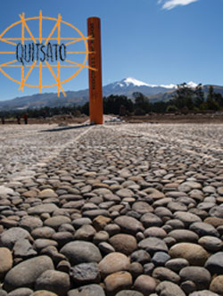
Catequilla, a unique mountain
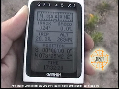
The project first discovered that a unique and unknown archeological site was located exactly at the zero latitude ( 0º 0´ 0" ). It is the peak of Mount Catequilla whose position was shown with the WGS 84 which is the most exact and up to date system in global positioning. This place possibly was not only the site of the Equinoccial Line placed by the pre-Incan culture, but could also be the principal axis for a very complex territorial arrangement that was developed approximately one thousand years ago.
Catequilla has an elevation of 2630 meters above sea level and is completely independent from the nearby mountains. This provides special characteristics, the most important of which is that it is found at 0º latitude, its peak has a visibility of 360 degrees from which 25 different ancient populations can be observed, absolutely all of the archeological sites of the region, without the help of optical instruments and so the observation is simple and direct. Its advantageous position in the middle of the 2 large Andean mountain ranges allowed the eastern slope to be used for observation of the rising and the western side for the setting of the stars. This is the only mountain in the world that has these characteristics.
The Indigenous people did not have optical instruments, which is the fundamental reason that the natural horizon of the mountainous relieves of the Andes have been used as the ideal tool for observations. It should be taken into account that the ancient inhabitant did not have optical instruments and therefore his principal tools were his vision and the horizon.
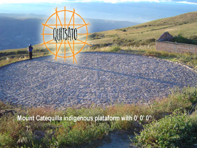
The archeological site presents a semicircular wall which is made of rocks and material from the site. It has an approximate diameter of 70 meters with a height of 1.80 meters. The incredible thing about this archeological structure is that the Equinoccial latitude passes exactly through the archeological site.
The Archeologist Oswaldo Tobar, began an archeological excavation on the hill of Catequilla in the month of April of 1999, and found pre-Incan ceramics in a volcanic deposit from the eruption of the Guagua Pichincha volcano that dates from 980 years ago according to the analysis by the volcanologist Patricia Mothes, Investigator for the National Polytechnic Geophysical Institute.
Parallel to this, he verified the relationship that exists between Catequilla and the different archeological sites of the Equinoccial region with the aid of a theodolite and a GPS. The result that was reached was that the most predominant sites, such as is the case with the pyramids of Cochasqui and the archeological site of Pambamarca, converge in the archeological center of Catequilla, following the rising and setting of the Sun during the solstices of June and December.
Other archeological sites are not only positioned in relation to the solstices but also to other directions based on astronomy. The majority of the sites have been positioned in a radiating pattern in this study and have managed to mark the routes with exact astronomical angles.
This evidence strongly supports the hypothesis that this archeological site was specifically constructed for astronomical observations. In addition, it might also have served as a pivot point for a large wheel in the territorial ordering of the ancient inhabitants of the zone.
The Point of View of Quitsa-to
This is a multi-disciplinary study with archeological and astronomy bases directed towards making a correct interpretation of the significance and function of the pre-Hispanic cultural contexts existing in the area of the Equinoccial Andes.
The cultural contexts have been interpreted from different perspectives, such as military forts, unfortunately these interpretations are ambiguous and lack scientific bases and arguments. But when Astronomy is applied, concrete evidence can be found which do not provide measurable, quantifiable and provable data.
This project stems from a point of view for the interpretation of the cultural context that we consider most appropriate, because it is related to the pre-Hispanic cosmo-vision. It also wishes to contribute with an adequate study of the natural elements like the celestial bodies and geological structures that possibly contributed to the selection and location of the different archeological sites by the societies existing before the Spanish conquest.
The most advanced technology that exists was applied such as satellites, global positioning systems and geographical information systems (GIS); the documenting of the contexts of study through photographic and video format, plans, maps, satellite images and digitalization, in order to carry out an integrated study.
The astronomical pattern of Quito
The apparent movements of the Sun are marked by the solstices and equinoxes determined by the integration of the plane of the Heavenly Equator with respect to the plane of the orbit of the Earth in the solar system, which is 23.5º. At the same time, the respective rising and settings of the sun during these important dates project alignments, which were used by the ancestral cultures to determine the positioning of other sites within their geographical-astronomical network. These alignments of the solstices and equinoxes in turn can be perpendicularly projected through their respective axes, such as is the case with the alignment of the equinoxes that corresponds to East 90º and West 270º, respectively and their corresponding axis is North 0º and South 180º, likewise, the perpendicular axes of the solstices or the ecliptic plane end up being the axes of the ecliptic.
These alignments with the respective axes are replicated in the archeological sites in order to try to find an astronomical - geographical relationship with respect to other archeological sites in the region in question. These alignments should have 2 or more archeological sites and at the same time the archeological sites should accumulate different alignments in order to find an astronomical relationship.
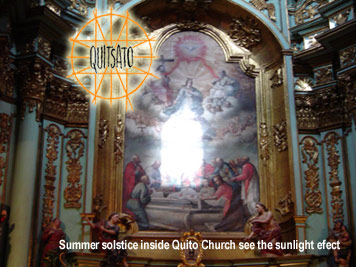
During recent years to the date of this publication, a film has been made of the luminescent phenomena of astronomical influence and therefore the project has a record of these. These phenomena occur in exact moments related to the solstices and equinoxes.
These archeo-astronomy studies help to resolve the orientation of colonial arquitechtonic groups as well as pre-Hispanic ones. As an example we can indicate the San Francisco Church, the El Quinche Church or the Rumicucho site.
These sites that correspond to the positions of pre-Hispanic archeological sites obey a certain logic which has been subjected to different tests within the project, which has allowed us to understand that the different arquitectonic implantations have an astronomical character and therefore luminescent phenomena have been discovered in the respective sites which are perfect and betray the astronomical functionality. The Quitsa-To project has been able to resolve the agreement between the archeological site and the heavenly mechanics that was the fundamental reason not only for choosing the site but also for have built it. The conclusions that have been indicated are soon to be published.
The best medium to achieve the valuation of these ancient structures is reaching an understanding of them from the aspect of their true function, according to the use for which they were built and used. This is the only way to reach an understanding of the value and function that they one day had for the society that lived in this region and only in this way can the current society understand the importance of the existence and conservation of these areas. Secondarily, enlightening information can also be obtained about the historical processes that have affected the region, which would allow us to understand many factors that have occurred up to the present day, such as the use of geographical space, the use of the soil and the natural resources. Our cultural identity.
|